
 Image source, BBC Weather Watchers / Helen Earth
Simon King
Lead Weather Presenter
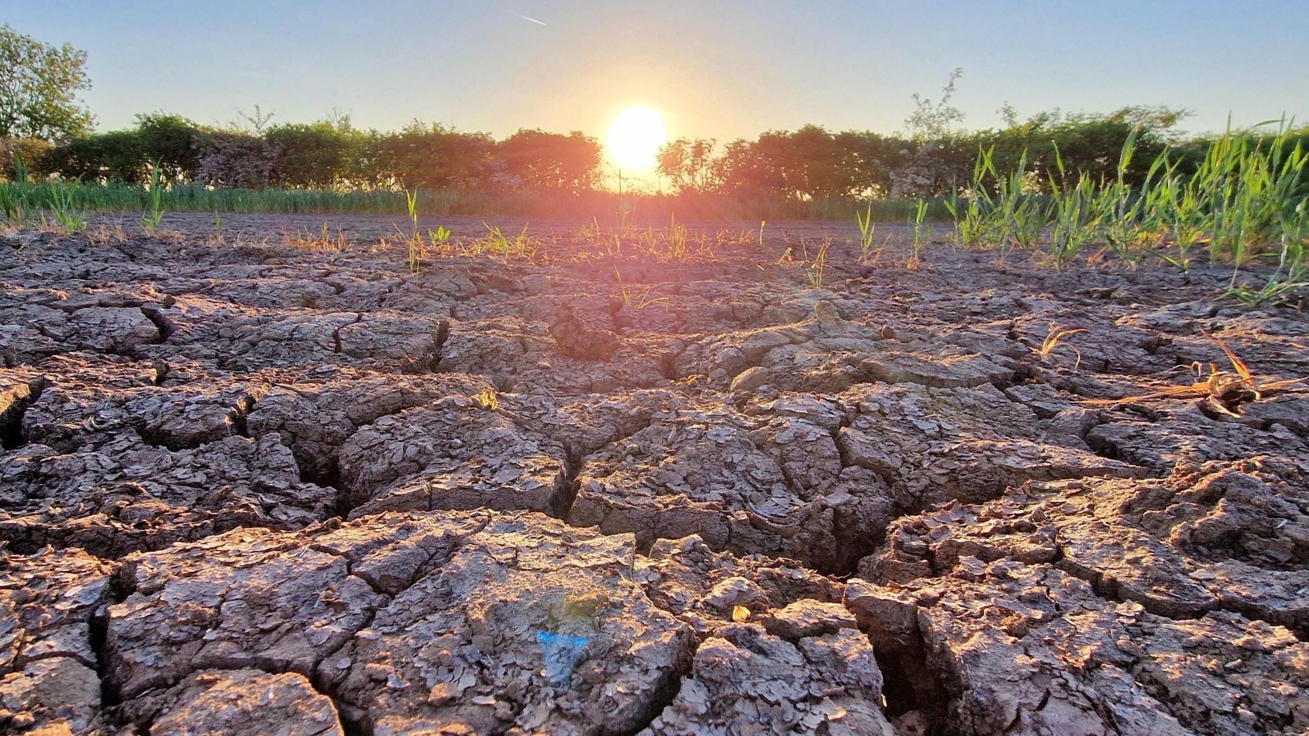
While some parts of the United Kingdom experienced heavy showers and thunderstorms early this week, the warm and dry weather has been dominant.
This spring is currently running at the driest on record according to the Met Office.
And the mostly dry weather is expected to continue across the UK for at least another 10 days.
The Environment Agency has said that while reservoirs are currently fairly healthy, there is a "medium" risk of a summer drought.
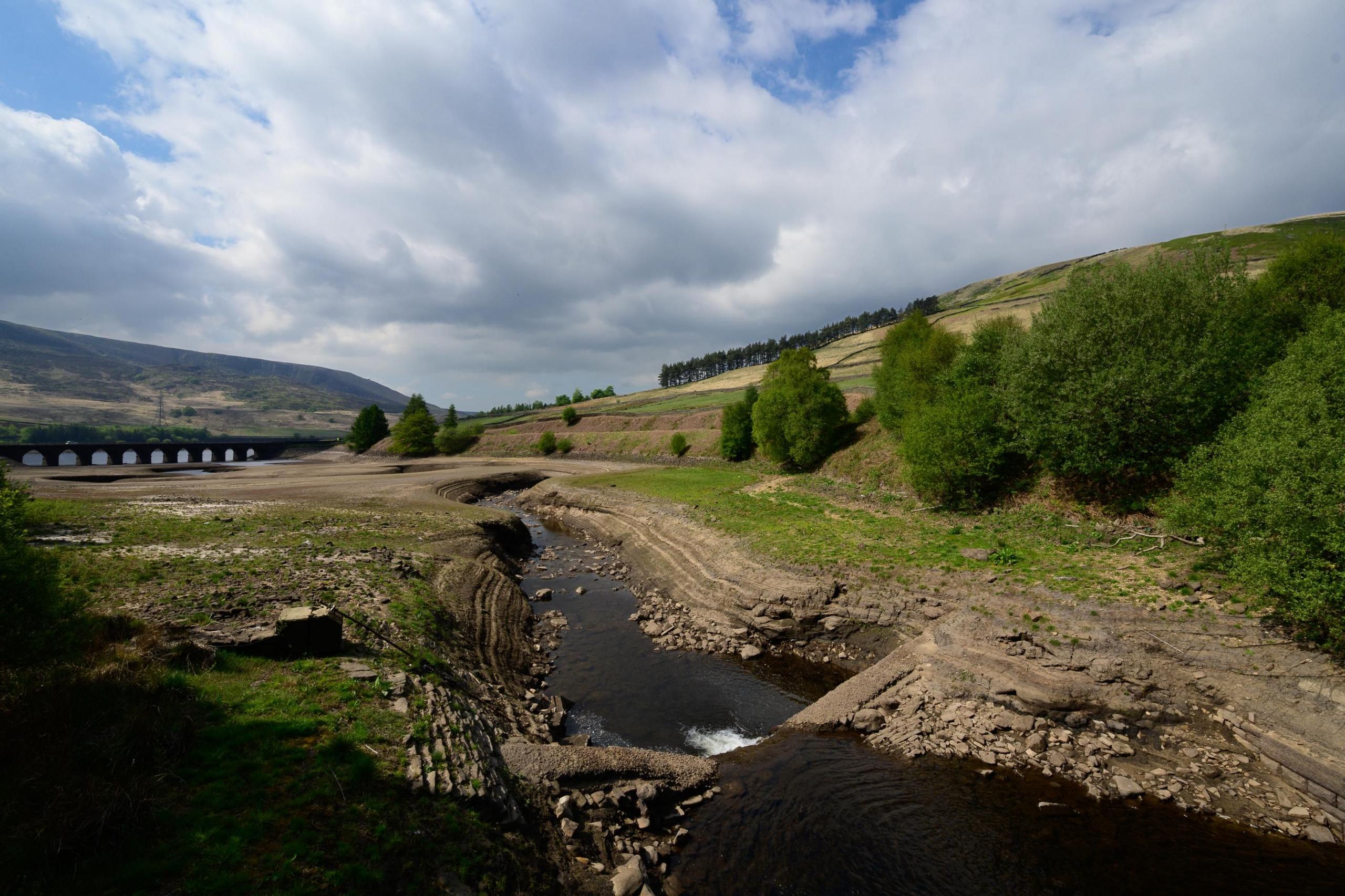 Image source, BBC Weather Watchers/ Sandie's Valley
Some rivers and reservoirs across the UK are starting to look much lower than normal, like the Woodhead Reservoir in Derbyshire
Some parts of Greater London, Hampshire, Greater Manchester, Lancashire and Yorkshire have had 20 days without a drop of rain.
And while there has been some measurable rain in other parts, May rainfall accumulations are way below average.
Since the start of spring in March, some areas such as Wales and south-west England have had healthy rainfall, overall it has been lacking.
In fact, the Met Office told BBC Weather that with a UK average rainfall accumulation of just 80mm so far this spring, compared to an average of 229mm, we're currently running at the driest spring on record.
As well as being unusually dry, there has also been a lot of sunshine. April was the sunniest on record in the UK, following the third sunniest March ever.
Sunshine is also running at above average so far in May.
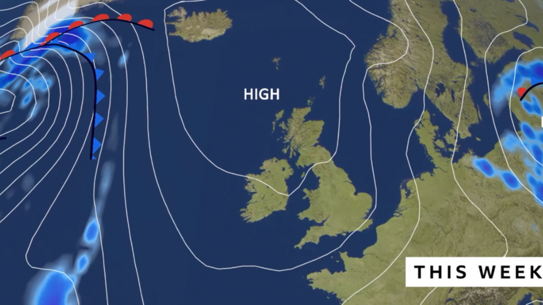 Image source, BBC Weather
High pressure brings settled, dry and mostly sunny weather this week across the UK
High pressure dominates
Through this week, high pressure will become firmly established to the north of the UK.
High pressure - air descending in the atmosphere - leads to settled weather and more often, mostly sunny conditions too.
This area of high pressure looks like it might stick around until around the end of next week.
Though being so far away in forecasting science, that breakdown to more unsettled weather could shift a few days either side.
Sunshine and above average temperatures into the low to mid-twenties is likely for most of us.
But, with a north-easterly wind, northern and eastern parts of the UK will be susceptible to low cloud, mist and fog coming in off the North Sea.
This will also bring cooler weather with temperatures in the low to mid-teens.
Will there be hosepipe bans?
In their latest meeting, the National Drought Group suggested that while no area is currently in official drought, "there is a medium risk of one this summer without sustained rainfall".
The Environment Agency has urged water companies to do more to safeguard water supplies.
And went on to say "while there are currently no plans for hosepipe bans, if the prolonged dry weather continues, water companies may need to implement their dry weather plans in the weeks and months ahead".
The Environment Agency and National Resources Wales will be closely monitoring the situation in the coming weeks.
The last time the UK was officially in drought was during the summer of 2022 with hosepipe bans for 19 million customers.
For comparison, reservoir levels in spring 2022 were higher at around 90%, full compared to around 80% this year.
And, in terms of rainfall, in spring 2022 we saw around 78% of expected rainfall compared to 35% so far this year.


 English (US) ·