
 Image source, PA Media
Chris Fawkes
Lead Weather Presenter
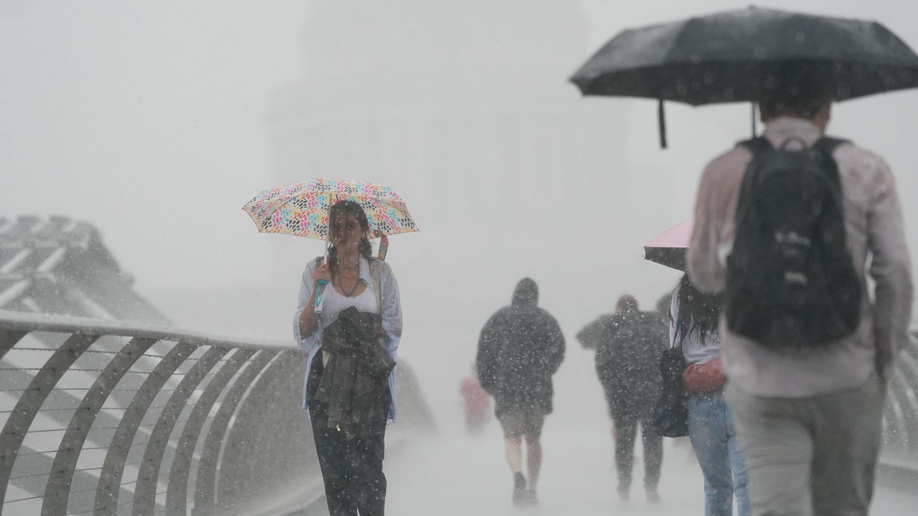
Amber thunderstorm warnings have been issued for Saturday morning by the Met Office for parts south-east and eastern England.
Rain will be torrential with 20-40mm (about an inch) in an hour but as much as 70-100mm (up to 4 inches) in a few hours. This is over a month's worth falling in places, leading to areas of flash flooding and very significant disruption.
The amber warnings come into force from 0400 to 1100 on Saturday with a raft of yellow warnings also in force across a wide area of England and Scotland.
Frequent lightning, large hail and gusty winds are additional hazards that would bring transport disruption.
Which areas will be most affected?
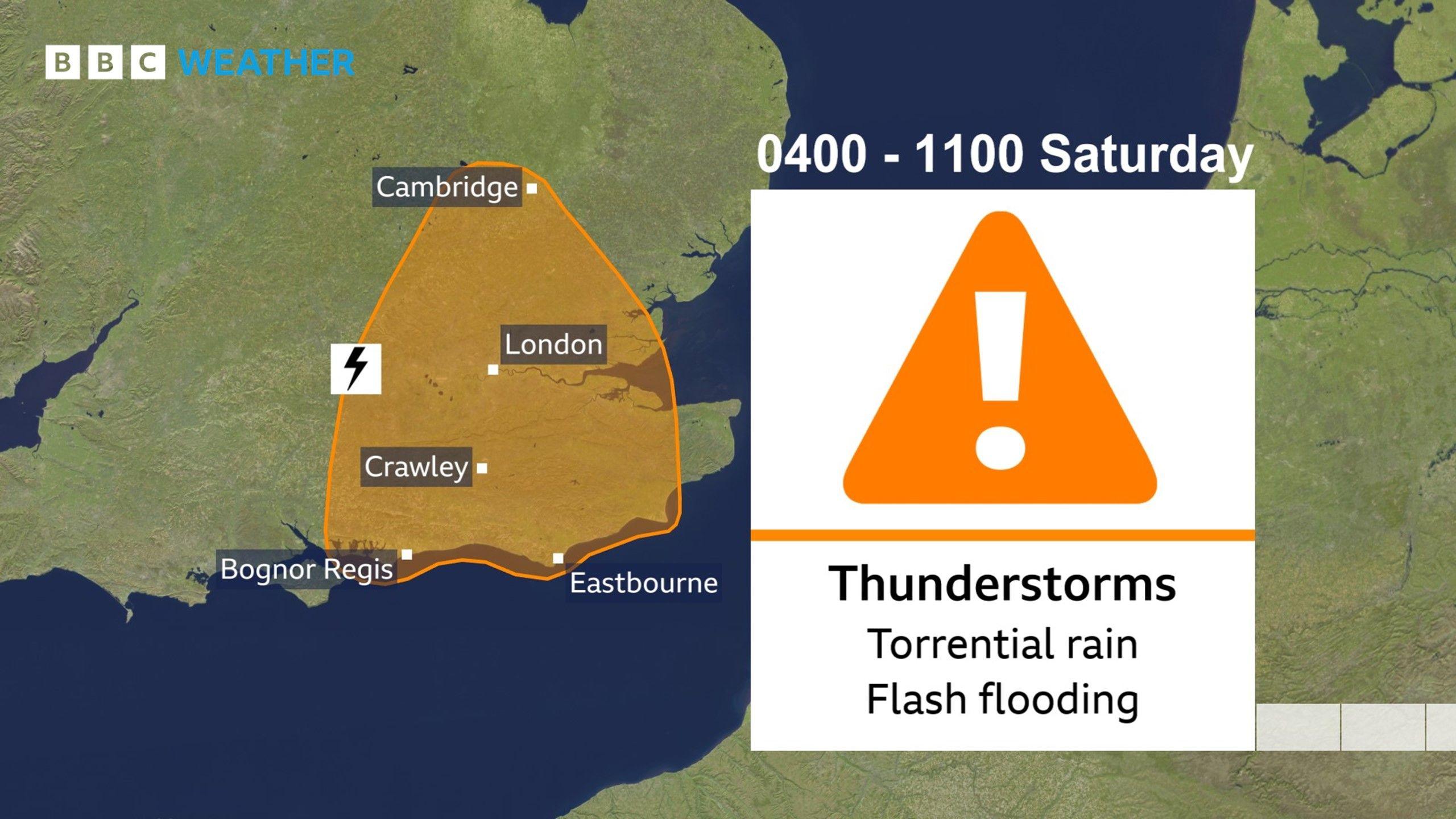
Met Office Amber weather warning for Saturday
The thunderstorms and heavy rain are likely to roll into central southern England, south-east England and the Midlands on Friday night before moving to northern England and Scotland by Saturday.
This area of rain could become slow-moving across northern Scotland during Sunday, with a threat of some flash flooding.
Low pressure looks set to take hold of the weather across the UK on Sunday and Monday with further widespread showers and thunderstorms likely.
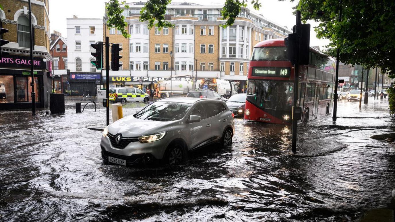 Image source, Getty Images/Leon Neal
Thunderstorms brought flash flooding to London 17 August 2022 following summer heatwaves
Thunderstorms always bring large variations in rainfall amounts from one place to the next, but some again could bring heavy downpours with a few areas of flooding.
Soils have been baked dry especially across England and east Wales after three successive summer heatwaves.
Heavy rains cannot easily be absorbed by dry soils, external with water tending to run off rapidly bringing a greater chance of seeing some areas of flash flooding.
Will this heavy rain affect the hosepipe bans?
Hosepipe bans have been announced over recent weeks affecting millions of people as drought is declared across more areas of the UK, external.
According to Helen Wakeham, Environment Agency Director for Water and National Drought Group chair: "This has been the driest start to the year since 1976."
Because the rain will be very heavy in places, it will runoff rapidly, perhaps overwhelming local sewers, before heading to the rivers and out to sea. At this time of year, any rainwater that does make it into the ground will just be taken up by growing plants and trees, so won't affect groundwater levels much.
To see a substantial recovery in reservoir and groundwater aquifer levels we'd need a more sustained spell of much wetter weather, this is typically what we see during our autumn or winter, so the hosepipe bans will likely last for the rest of summer and probably into the first part of autumn too.


 English (US) ·